Peninsula of Sinai
- Date
- 1892
- Publication
- The Bible-Work: The Old Testament, Vol. II
- Imprint
- Prepared by J. Glentworth Butler, D.D. · Funk & Wagnalls Company, New York and London, 1892
- Full Color
Description
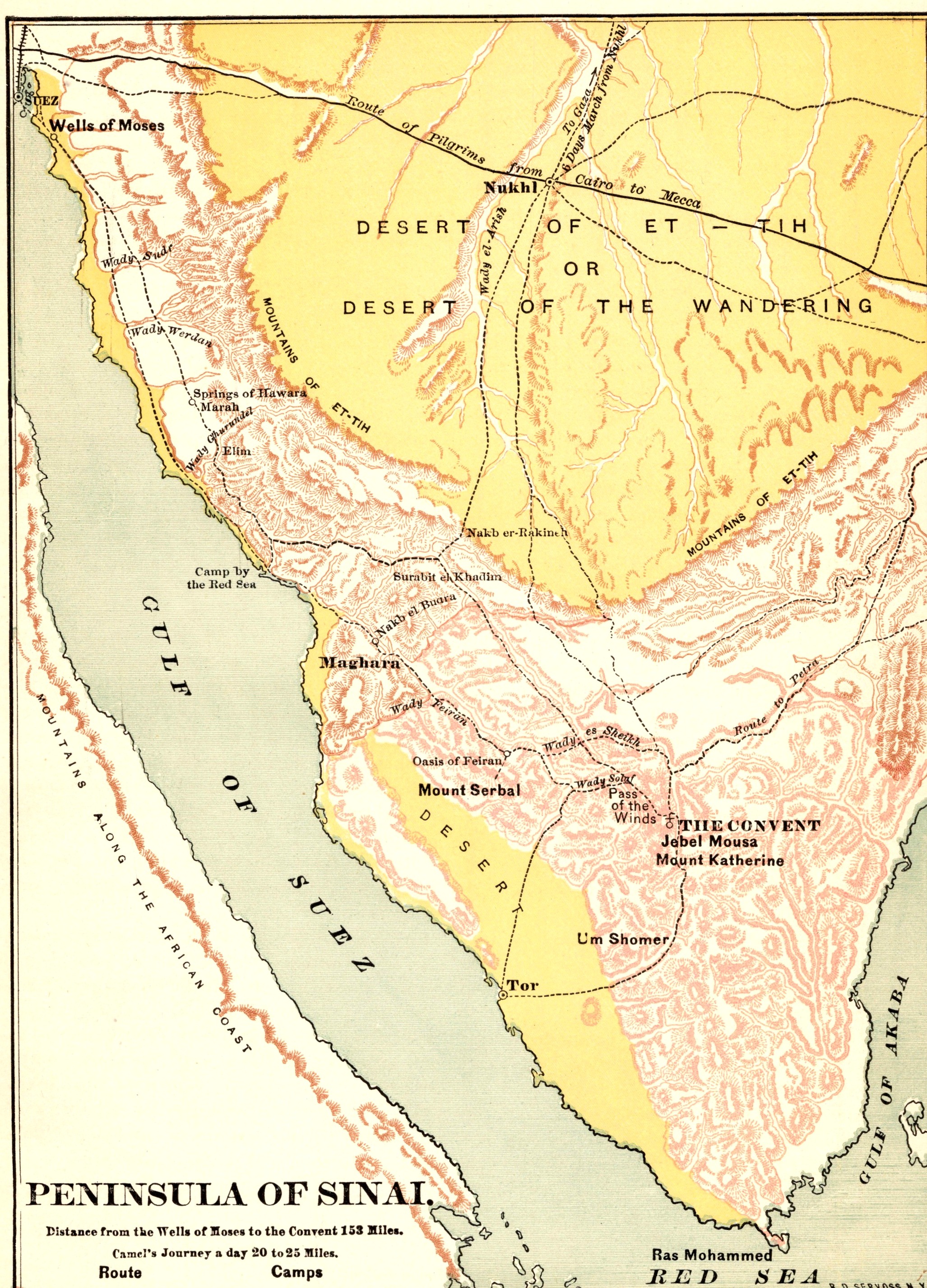
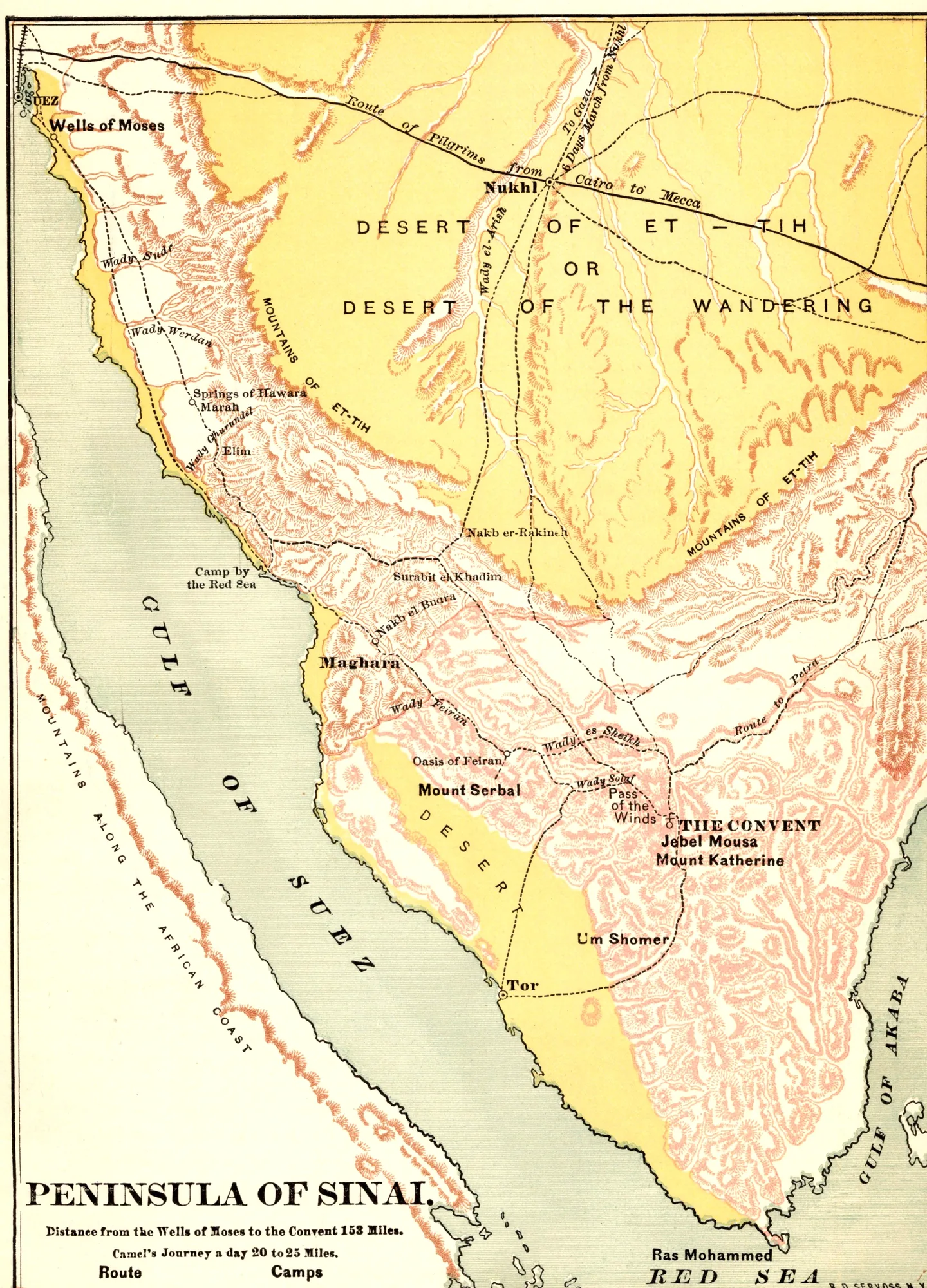
A color map of the whole Sinai Peninsula, with the Desert of Et-Tih or Desert of the Wandering shaded in yellow across the north and the mountains of the south in pink. It traces a route from the Wells of Moses near Suez down to the convent at Jebel Musa, notes that a camel covers 20 to 25 miles a day, and marks Mount Serbal, Tor, the Gulf of Suez and the Gulf of Akabah.
As printed
Peninsula of Sinai. Distance from the Wells of Moses to the Convent 158 Miles. Camel’s Journey a day 20 to 25 Miles.
Cite this item
“Peninsula of Sinai.” Illustration in The Bible-Work: The Old Testament, Vol. II, Prepared by J. Glentworth Butler, D.D. · Funk & Wagnalls Company, New York and London, 1892. Antique Advertisements, no. P0333. https://antiqueadvertisements.com/from-the-pages/P0333-peninsula-of-sinai-1892/
This item is in the public domain. You are free to use it for any purpose; a credit to Antique Advertisements is appreciated. Learn more about using these images.