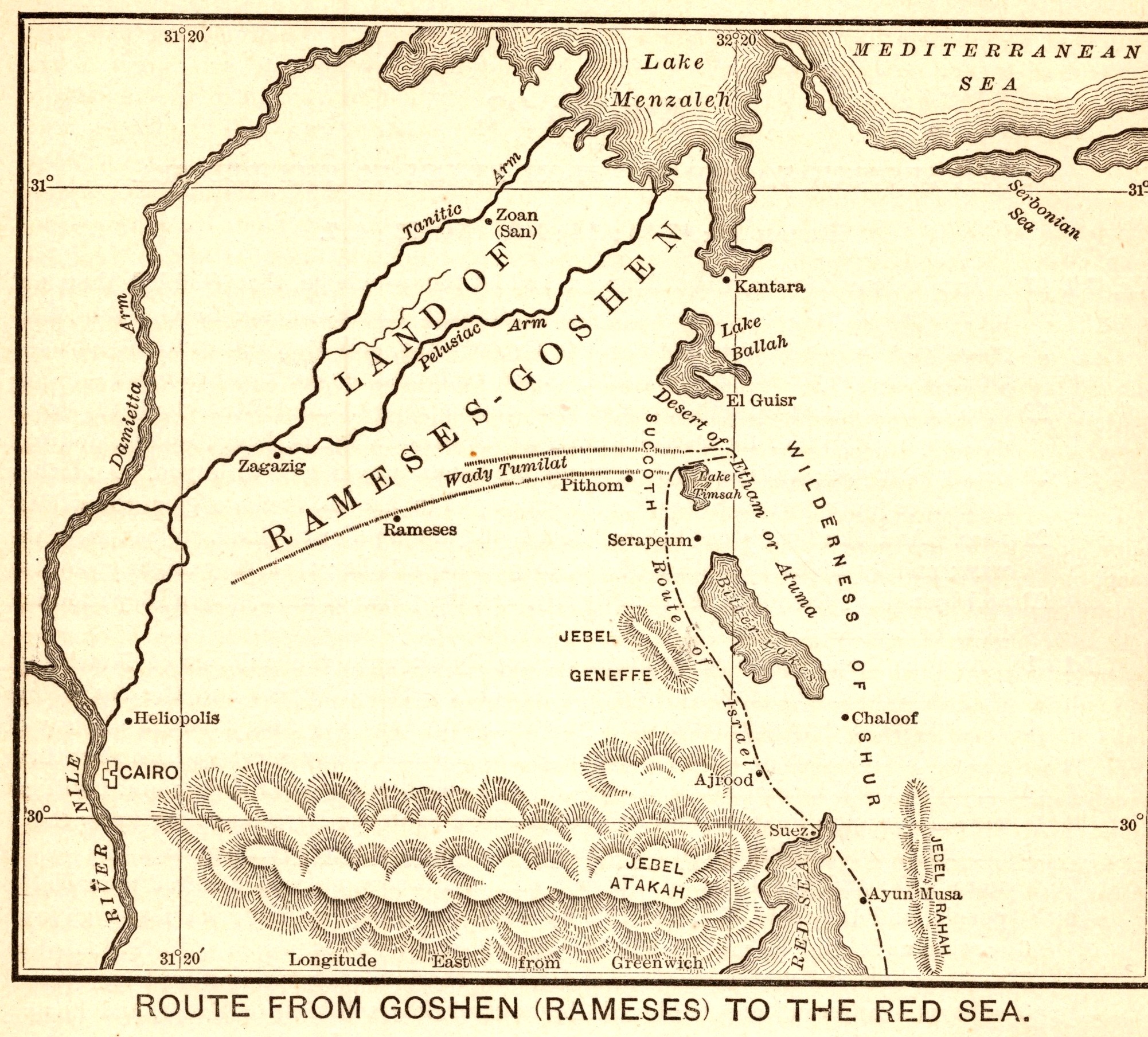
Route from Goshen (Rameses) to the Red Sea
- Date
- 1892
- Publication
- The Bible-Work: The Old Testament, Vol. II
- Imprint
- Prepared by J. Glentworth Butler, D.D. · Funk & Wagnalls Company, New York and London, 1892
- Page
- 34
- Black & White
Description
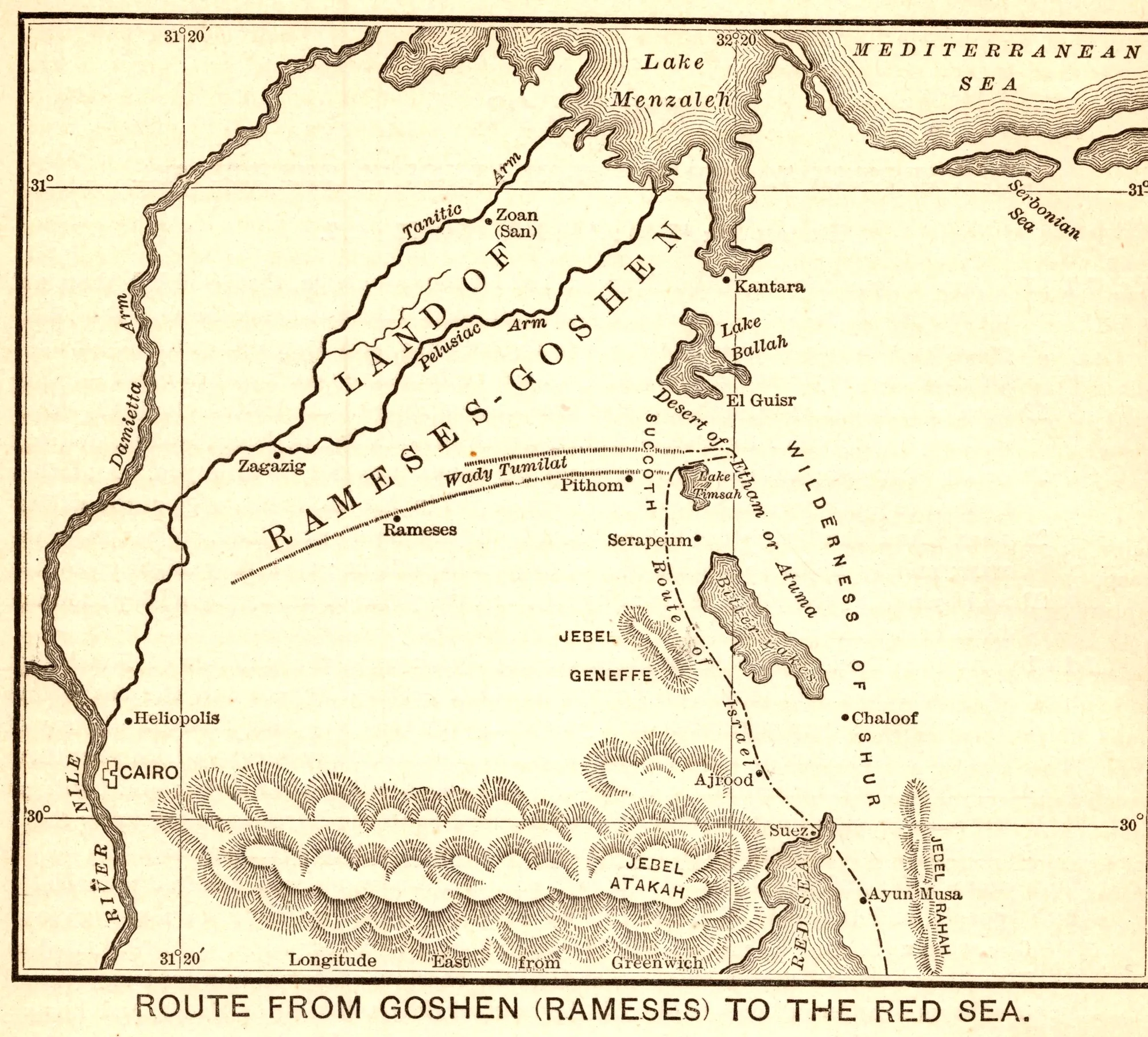
A map of the eastern Nile Delta tracing the route the Israelites are said to have taken out of Egypt, from the Land of Goshen and the city of Rameses toward the Red Sea. It marks the branches of the Nile, Lake Menzaleh, the Bitter Lakes, Cairo and Jebel Ataka, with the line of the route drawn across the desert. It illustrates the section of the commentary covering the march from Succoth to Etham.
As printed
Route from Goshen (Rameses) to the Red Sea.
Cite this item
“Route from Goshen (Rameses) to the Red Sea.” Illustration in The Bible-Work: The Old Testament, Vol. II, Prepared by J. Glentworth Butler, D.D. · Funk & Wagnalls Company, New York and London, 1892. Antique Advertisements, no. P0318. https://antiqueadvertisements.com/from-the-pages/P0318-route-from-goshen-rameses-to-the-red-sea-1892/
This item is in the public domain. You are free to use it for any purpose; a credit to Antique Advertisements is appreciated. Learn more about using these images.