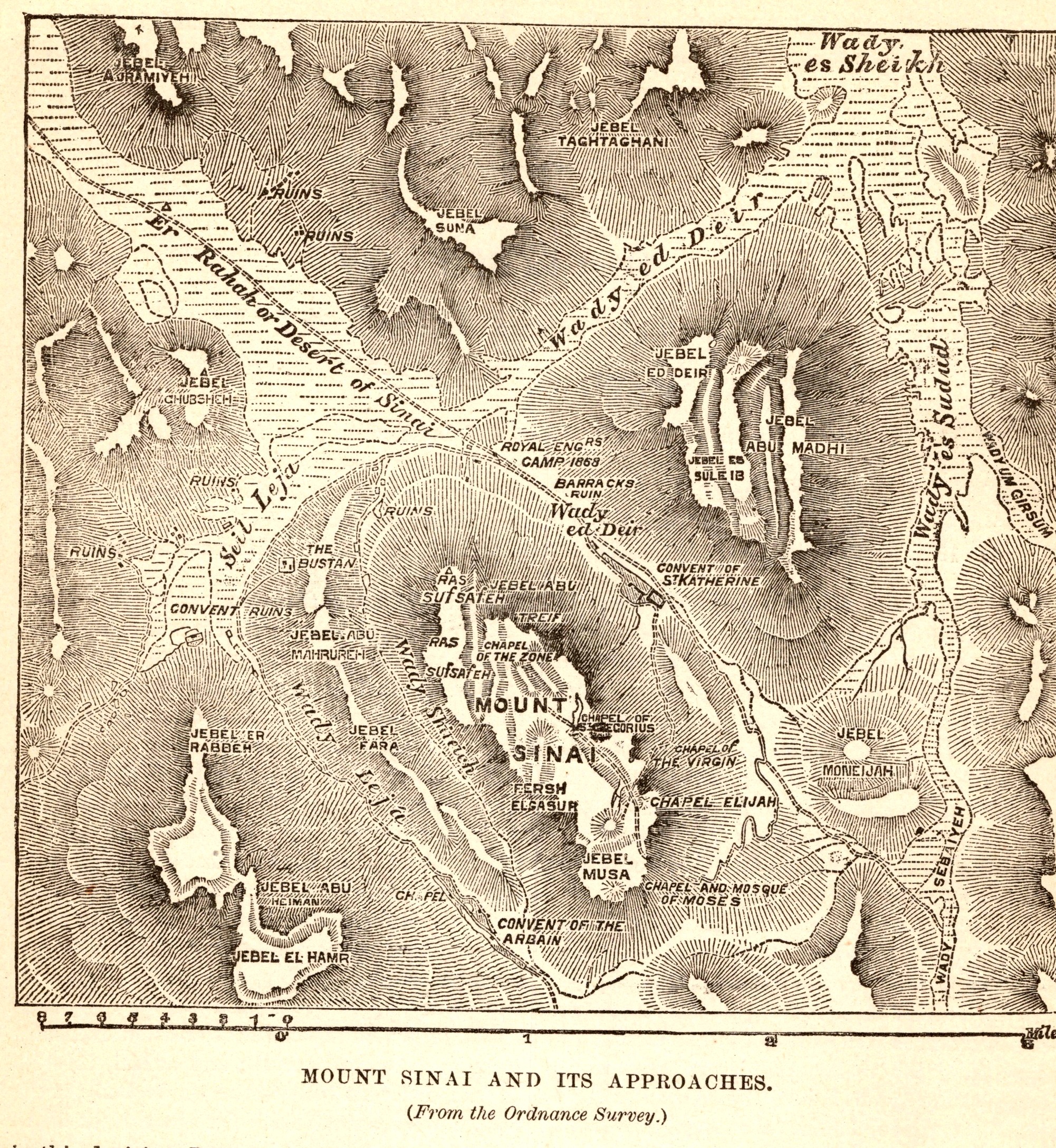
Mount Sinai and Its Approaches
- Date
- 1892
- Publication
- The Bible-Work: The Old Testament, Vol. II
- Imprint
- Prepared by J. Glentworth Butler, D.D. · Funk & Wagnalls Company, New York and London, 1892
- Page
- 98
- Black & White
Description
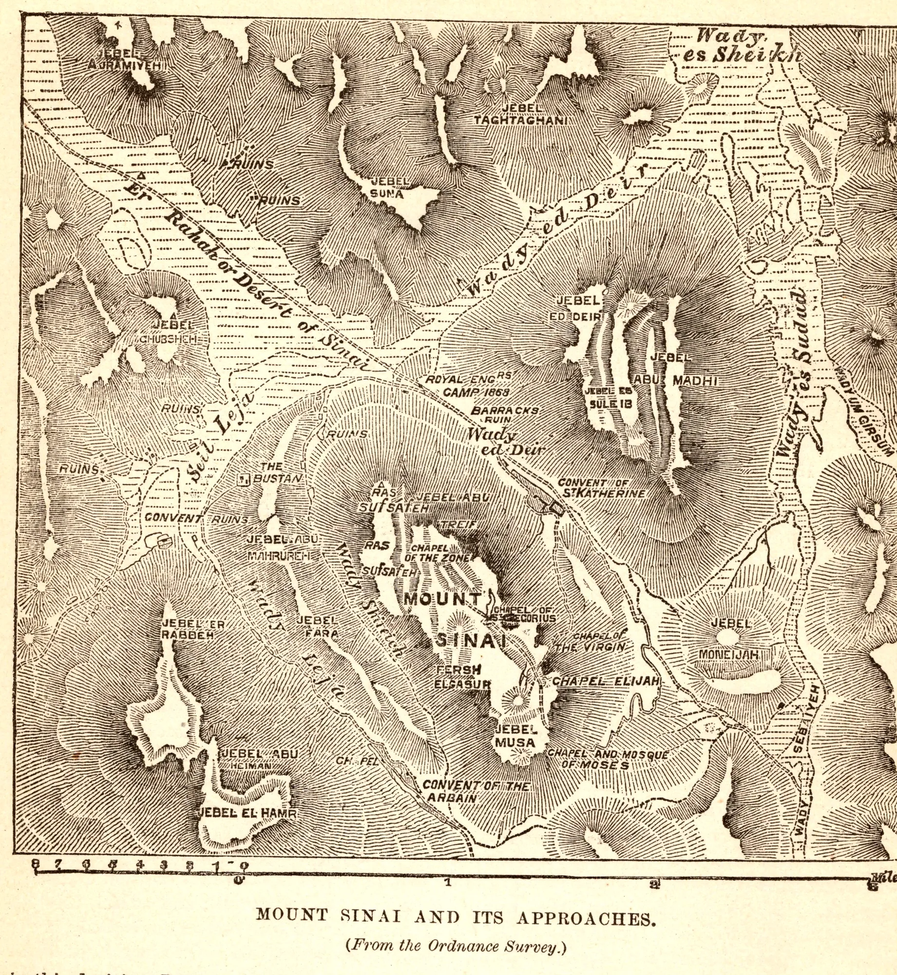
A hachured relief map of the mountains around Jebel Musa, drawn from the British Ordnance Survey of the Sinai Peninsula carried out in 1868 and 1869. It marks Mount Sinai, Jebel Musa, Ras Sufsafeh, the Convent of St. Catherine and the wadis leading to the Plain of Er Rahah, with a scale in miles.
As printed
Mount Sinai and Its Approaches. (From the Ordnance Survey.)
Cite this item
“Mount Sinai and Its Approaches.” Illustration in The Bible-Work: The Old Testament, Vol. II, Prepared by J. Glentworth Butler, D.D. · Funk & Wagnalls Company, New York and London, 1892. Antique Advertisements, no. P0331. https://antiqueadvertisements.com/from-the-pages/P0331-mount-sinai-and-its-approaches-1892/
This item is in the public domain. You are free to use it for any purpose; a credit to Antique Advertisements is appreciated. Learn more about using these images.