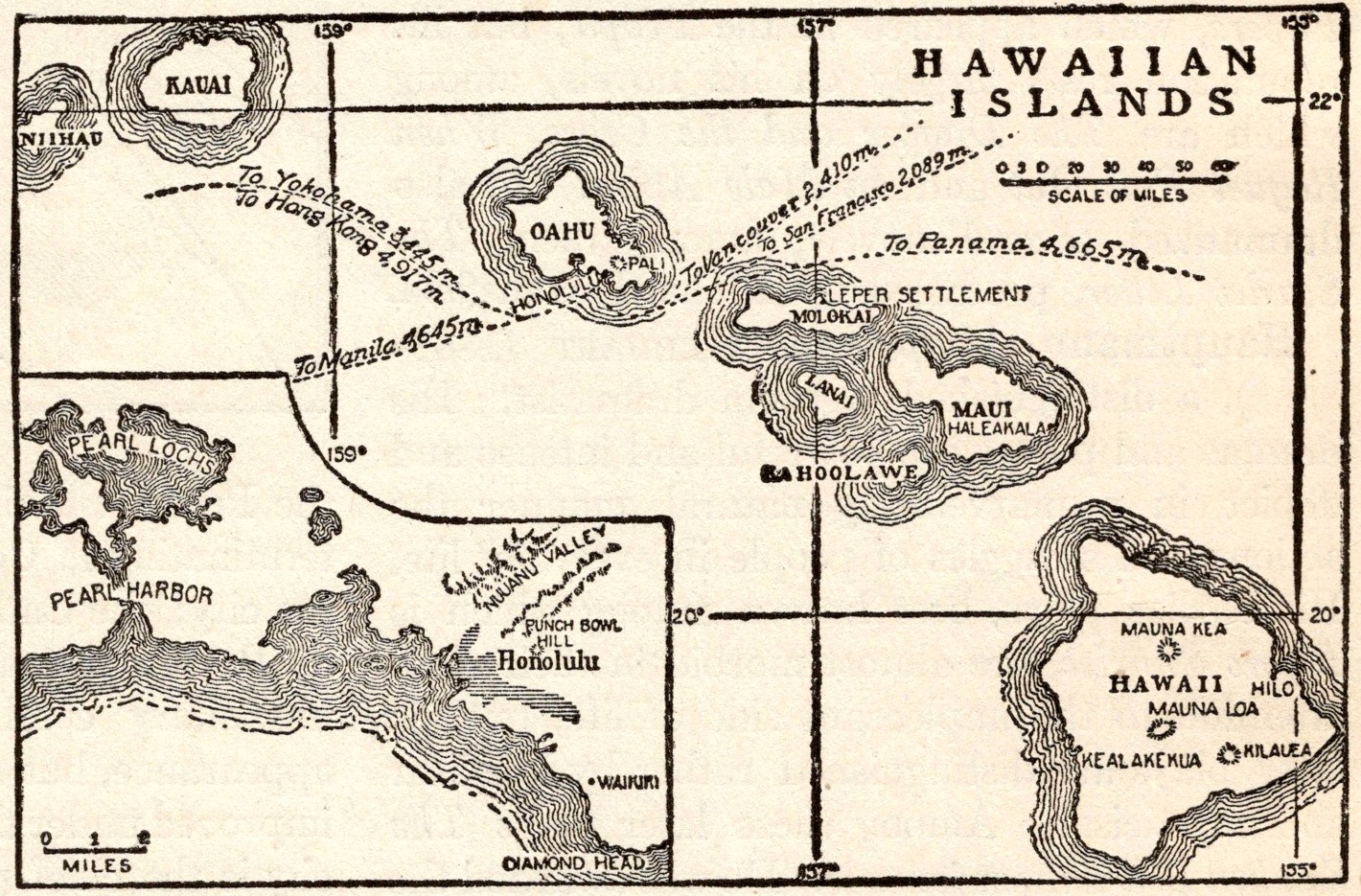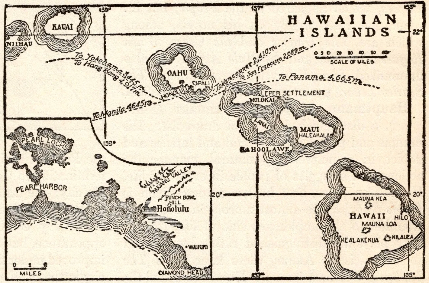
Map of the Hawaiian Islands
- Date
- 1918
- Publication
- The New Practical Reference Library, Vol. IV
- Imprint
- Charles H. Sylvester, editor in chief · Creecy-Smith Publishing Company, Kansas City and Dallas, 1918
- Black & White
Description
An uncaptioned map from the entry on the Hawaiian Islands, which the text places about 2200 miles southwest of San Francisco. It shows Kauai, Oahu, Molokai, Lanai, Maui, Kahoolawe and Hawaii, with an inset of the island of Hawaii marking Mauna Kea, Mauna Loa, Kilauea and Hilo, and steamer routes between the islands.
Historical note
When this volume appeared, Hawaii was a U.S. territory. American-led businessmen had overthrown Queen Liliʻuokalani in January 1893, and Congress annexed the islands in 1898 during the Spanish-American War. Hawaii became the 50th state on August 21, 1959.
Sources
- Hawaii Annexed to the United States, EBSCO Research Starters
- How white planters usurped the last Hawaiian queen, National Geographic
Cite this item
“Map of the Hawaiian Islands.” Illustration in The New Practical Reference Library, Vol. IV, Charles H. Sylvester, editor in chief · Creecy-Smith Publishing Company, Kansas City and Dallas, 1918. Antique Advertisements, no. P0406. https://antiqueadvertisements.com/from-the-pages/P0406-map-of-the-hawaiian-islands-1918/
This item is in the public domain. You are free to use it for any purpose; a credit to Antique Advertisements is appreciated. Learn more about using these images.