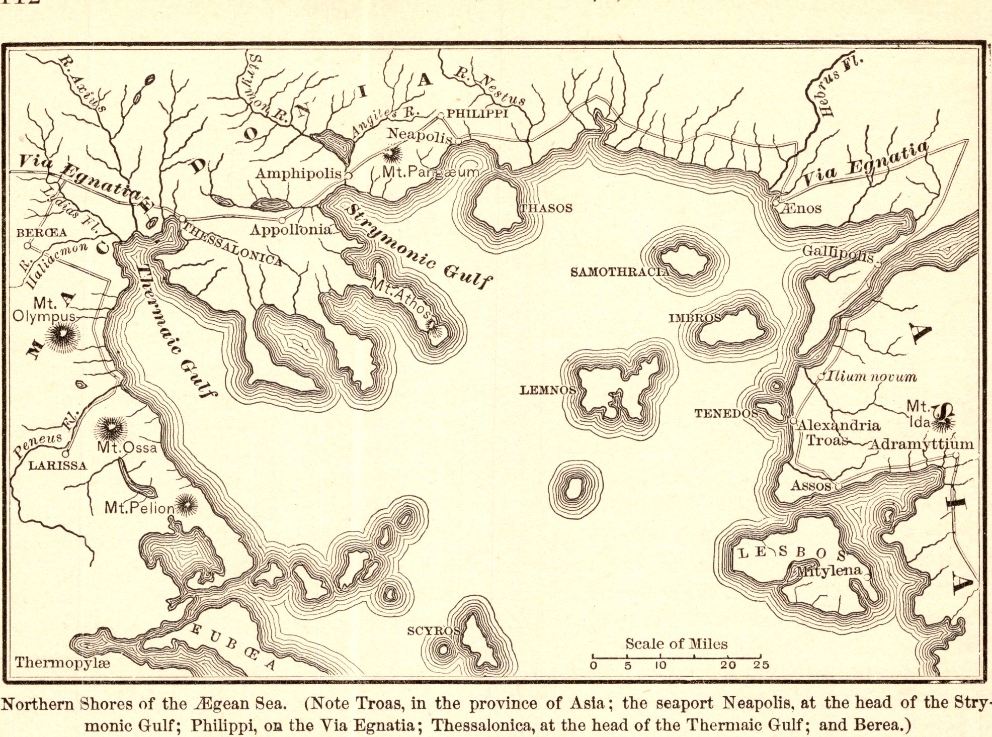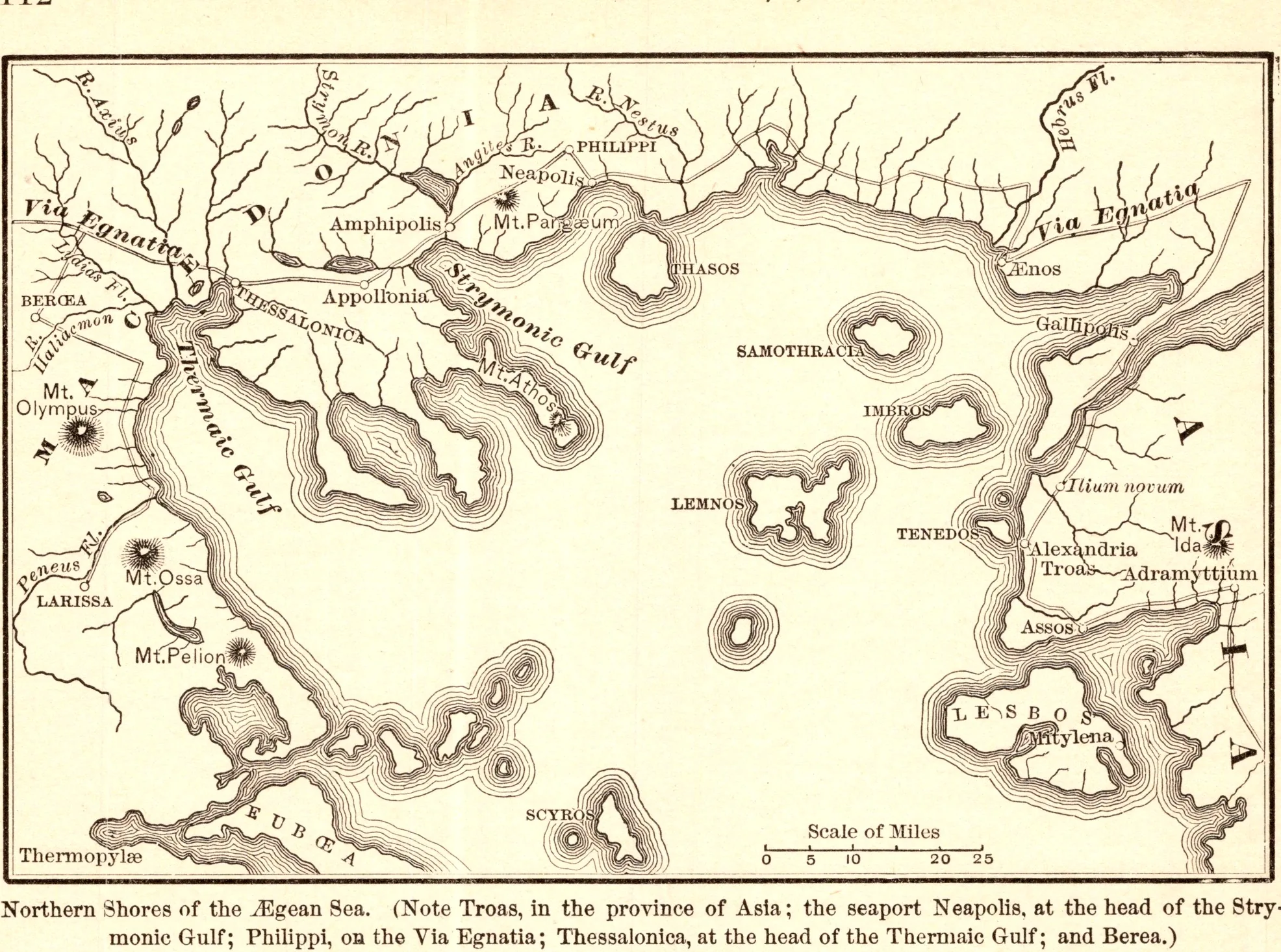
Northern Shores of the Ægean Sea
- Date
- 1883
- Publication
- The Bible-Work: The New Testament, Vol. II
- Imprint
- Prepared by J. Glentworth Butler, D.D. · Funk & Wagnalls Company, New York and London, 1883
- Page
- 112
- Black & White
Description
A map of the northern Aegean from Troas to Macedonia, following Paul’s second journey into Europe: the port of Neapolis, Philippi on the Via Egnatia, Amphipolis, Thessalonica, Berea and the islands of Samothrace, Lemnos and Thasos.
As printed
Northern Shores of the Ægean Sea. (Note Troas, in the province of Asia; the seaport Neapolis, at the head of the Strymonic Gulf; Philippi, on the Via Egnatia; Thessalonica, at the head of the Thermaic Gulf; and Berea.)
Cite this item
“Northern Shores of the Ægean Sea.” Illustration in The Bible-Work: The New Testament, Vol. II, Prepared by J. Glentworth Butler, D.D. · Funk & Wagnalls Company, New York and London, 1883. Antique Advertisements, no. P0360. https://antiqueadvertisements.com/from-the-pages/P0360-northern-shores-of-the-aegean-sea-1883/
This item is in the public domain. You are free to use it for any purpose; a credit to Antique Advertisements is appreciated. Learn more about using these images.